Call Now: (540)-580-7184

History of Smith Mountain Lake
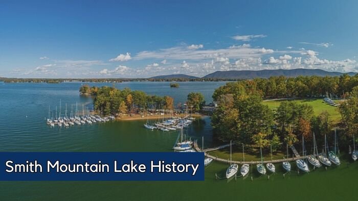
The history of Smith Mountain Lake dates back to 1963 when the first Smith Mountain Dam was constructed. The lake is located in Virginia’s Roanoke Region which impounds the Roanoke River. This reservoir can be found southeast of Roanoke City and southwest of Lynchburg.
Franklin County predominantly encompasses it along its southern shore, with a minor portion extending into Pittsylvania County, including the dam’s access points. The northern part of the lake is within Bedford County, with the Roanoke River serving as the natural demarcation line.
Recently, Smith Mountain Lake has emerged as a favored destination for recreational activities such as boating and fishing and witnessed considerable development. It is also the largest lake confined within the borders of the Commonwealth of Virginia.
History of Smith Mountain Lake
Smith Mountain Lake extends over 40 miles, encompasses 20,000 acres of water, and is surrounded by 500 miles of shoreline. Its surface reaches 795 feet above sea level at full pond. This makes it a large lake, not just in terms of size but also in its role as a recreational hub and power generation site.
Compared to other lakes, the history of Smith Mountain Lake is relatively new, having been created as a result of dam construction that began in 1960. Its inception was similar to that of Claytor Lake in Pulaski to the south. Both lakes formed by damming rivers to generate electrical power for the Appalachian Power Company. The Smith Mountain Dam stands with the capacity to produce 605,000 kilowatts of power.
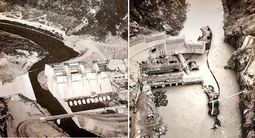
The construction of the Smith Mountain Dam was a six-year project requiring a 200-person crew. This effort involved clearing 300,000 cubic yards of forest and utilizing 175,000 cubic feet of concrete for the dam. Workers installed a 1,500-foot cable between mountains to move materials, totaling half a million tons. They completed the dam in September 1963, and the Blackwater and Roanoke Rivers then formed Smith Mountain Lake.
By March 7, 1966, the lake had reached its full capacity, marking the birth of what would become known as the recreational capital of Southwest Virginia.
How was Smith Mountain Lake Formed?

American Electric Power initiated a hydroelectric project that formed Smith Mountain Lake. This project was situated on the Roanoke/Staunton River, precisely at a natural break within Smith Mountain.
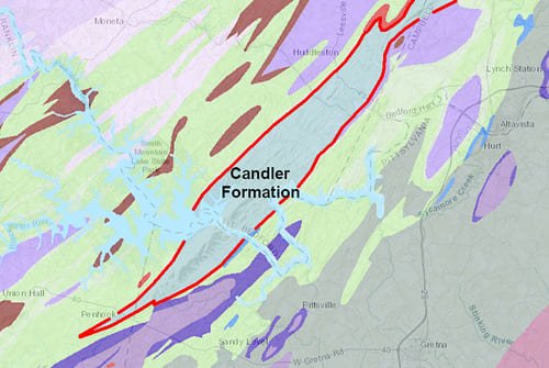
The river itself had naturally carved out this break through the Candler Formation, leading to the differential erosion that formed the Smith Mountain ridge, which stands at a height of 1,000 feet.
When was Smith Mountain Lake Dam Built?
The initial suggestion for a hydroelectric dam at Smith Mountain Gap was made in 1906. It coincided with the construction of the Niagara Dam and decades after the first U.S. hydroelectric plant began operations in Wisconsin. By 1924, the Roanoke-Staunton River Power Company had acquired 4,500 acres in Bedford and Pittsylvania counties for potential development.
The 1926 Rivers and Harbors Act recommended building several dams along the Roanoke River for flood control and hydropower. However, the proposal for a dam at Smith Mountain Gap was not initially pursued due to profitability concerns and lack of Congressional approval.

After World War II, interest in dam construction, including at Smith Mountain, renewed. Debates over private versus federal development for power generation marked this period. The coal and railroad sectors opposed private hydroelectric projects, fearing a decrease in coal demand. Despite this, the push for such projects gained momentum under President Eisenhower’s administration.
The pivotal 1953 Supreme Court decision affirmed the Federal Power Commission’s authority to approve private dam projects. This ruling paved the way for American Electric Power to acquire the Roanoke-Staunton River Power Company’s rights in 1954. Subsequently, they proceeded with plans to flood farmland for what would become Smith Mountain Lake. Despite local resistance, construction began in 1960. The lake filled by March 7, 1966, helped by significant snowfall.
Recreation in Smith Mountain Lake
Smith Mountain Lake has evolved into a favored destination for a variety of outdoor recreational activities. Popular activities on the water include boating, water skiing, wakeboarding, using personal watercraft, sailing, and notably, fishing for striped bass.
The lake also serves as a venue for numerous professional fishing competitions. Additionally, Smith Mountain Lake State Park, which opened in 1983, offers a beach and swimming area, while golfing is a preferred activity at four nearby courses.
While outdoor enthusiasts love SML, because of the countless activities available, we at All-Sport Mobile Service, are all about boating! To help you get on the lake, have a look at the different boat launches available around the Lake.
Locations of Smith Mountain Lake Public Boat Launches and Ramps
The locations of the Boat ramps and launches are listed from Roanoke River (at navigation marker R-87) in the north to Blackwater River (B-12) and Bull Run (BR-3) in the south.
- Hardy Ford Boat Launch (Hardy, Virginia) off Hardy Rd. (634), south of marker R87 (map)
- Hale’s Ford Boat Launch (Moneta, Virginia) off Timberwood Ln. (823) & Meadow Point (1550), east of marker R29 (map)
- Oak Grove Boat Launch (Moneta, Virginia) off Merriman Way Rd. (666) and Oldfield Rd., southwest of marker R28 (map)
- State Park Boat Launch (Huddleston, Virginia) off SML Parkway (626) & State Park Rd., northeast of marker R19 (map)
- Anthony Ford Boat Launch (Penhook, Virginia) off Smith Mountain Rd. (626) & Hardy Rd. (953), southwest of marker R6 (map)
- Penhook Boat Launch (Penhook, Virginia) off Rt. 40 & Morgan’s Fork (966), south of marker BR3 (map)
- Scruggs Boat Launch (Moneta, Virginia) off Scruggs Rd. (616) & Dudley Amos Rd. (601), at marker B12 (map)
How Many Boating Companies are there in Smith Mountain Lake, VA?
With the growing love for boating at Smith Mountain Lake in Virginia there is no shortage of boating companies. According to the Chamber of Commerce at SML, and listed on Google, there are more than 30 boating companies offering a wide range of services, including boat rentals, sales, marina and boat repair services.
There is no shortage of boating companies near SML. With boating being a popular activity, with options for everyone from casual boaters to serious anglers and water sports enthusiasts. The lake allows for a variety of boat types, including pontoons, tritoons, runabouts, deck boats, wake surfing boats, fishing boats, and personal watercraft like Jet Skis, Sea-Doos, and WaveRunners.
We at All-Sport Mobile Service are one of the more than 30 companies on Smith Mountain Lake! Our 25+ years of experience ensure boats are safe and function well! We’re here to help, whether you’re near All-Sport Mobile Service in the south or need repairs on the lake’s north side. You can contact us for boat services, or a recommendation for a company closer to your area.
Frequently Asked Questions about SML
The Smith Mountain Dam stands at 235 feet in height, 816 feet in length, and has a thickness of 30 feet. The dam uses a pumped storage system with water and coal which flows through turbines to generate electricity.
Downstream, Leesville Dam captures and pumps water back for reuse, including generating more power. American Electric Power mainly supplies the energy for water pumping through transmission lines.
The Vipperman Visitors Center, located in Pittsylvania County, is open to the public free of charge and throughout the year. While Appalachian Power previously conducted occasional tours through the inner workings of the dam, these were discontinued following the events of 9/11.
Visitors to the center can explore a range of exhibits that detail the construction of the Smith Mountain Project (dam) during the late 1950s and early 1960s. Operating hours are subject to seasonal changes, so it’s advisable to consult the website for the most current information.
Smith Mountain Lake reached its full capacity over a span of approximately 2.5 years, following the damming of the Blackwater and Roanoke Rivers. This process started on September 24, 1963, and concluded on March 7, 1966. Each year, March 7 is commemorated as Full Pond Day at Smith Mountain Lake, celebrating the day the lake was fully formed.
